
The Documented Hoboken ZIP Code: 07030
Research identifies 07030 as the documented USPS ZIP for Hoboken. It should be used as a postal starting point, not as a drawn municipal boundary. No official city or county ZIP-boundary map for Hoboken was located, so a specific address should be checked through USPS address and ZIP lookup rather than inferred from an office list.
| ZIP | Areas Covered | Post Office | Notes |
|---|---|---|---|
| 07030 | Documented USPS ZIP for Hoboken; no official city or county boundary map was located | Hoboken Main Office, 89 River Street, Hoboken, NJ 07030-9998 | Five city-listed service locations are not boundary evidence or resident lists |
The USPS listing for the Hoboken Main Office gives 89 River Street, telephone (201) 659-3017, and retail hours of Monday through Friday 8:00 to 5:00, Saturday 9:00 to 12:30, and Sunday closed.
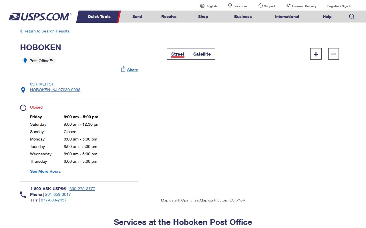
The office listing confirms a postal service location associated with 07030. It does not reveal a delivery boundary, who receives mail at an address, or whether a person connected with a record is a current resident.
Hoboken ZIP Address Search
The documented local workflow does not begin with a ZIP-wide people search. NJ GIS Property Explorer is documented for address, county, municipality, block, and lot, not ZIP. The New Jersey voter form includes a ZIP field, but the state status lookup’s current fields were not captured and there is no supported public ZIP-indexed voter roster.
- Use USPS address and ZIP lookup to obtain the standardized form for one known address, and note the lookup date because changes can take time to appear.
- Carry the standardized address into NJ GIS Property Explorer, selecting the documented address, county, municipality, block, or lot path that fits the clue.
- Use the Hoboken Tax Assessor for tax-list and assessment context. Its stated list includes property owners, mailing addresses, and assessments, which are not the same as proof of occupancy.
- For a street-by-street historical or parcel follow-through, continue with the Hoboken street directory after the address is standardized.
NJACTB is the official county-tax-board search entry for deed and owner paths, but the inspected live RecordSearch page required a CAPTCHA. Its exact field order, date range, parcel-card display, and export options should not be promised until an accessible live screen is captured.
New Jersey Property Tax Transparency describes property location and owner, block and lot, assessed land and building values, prior-year taxes, and classification. The data are filed annually in January, so a later transfer may not appear until a subsequent annual update. A protected owner name may also be masked under Daniel’s Law. These are property-record limits, not reasons to turn a ZIP result into an occupancy claim.
Hoboken ZIP Boundary Myth
Postal geography, municipal geography, county routing, parcel geography, election geography, and historical directory geography answer different questions. USPS delivery uses a ZIP; Hoboken is the municipality; Hudson County routes county functions; tax and GIS systems use block, lot, PIN, and parcel information; wards and districts organize elections; and old directories preserve printed street and address forms. These layers overlap without becoming interchangeable.
- ZIP
- A five-digit USPS postal code used for delivery and address standardization. It does not establish a municipal boundary or identify an occupant.
- ZIP+4
- An added delivery-segment refinement beyond the five-digit ZIP. USPS says it can identify delivery routes; it is not a parcel or household identifier.
- PO-box or unique ZIP
- These are postal concepts for box delivery or a dedicated institutional arrangement. The research did not verify either as a local Hoboken label, so neither should be inferred from a service location.
- Carrier route
- A delivery-routing concept. It is not a certified land boundary, ownership record, or resident directory.
| Postal layer | USPS tools can standardize an address and associate it with postal service information, but not establish a municipal boundary or occupant. |
|---|---|
| Municipal and county layer | City, Hudson County, and NJ GIS sources route a location to Hoboken or Hudson County; they do not define USPS delivery boundaries. |
| Parcel and tax layer | NJ GIS, NJACTB, and assessor sources can supply block, lot, PIN, owner, or tax context, but not current occupancy or a certified survey. |
| Historical directory layer | HPL and DigiFind-It can connect a historical person and printed address, but not supply a current ZIP or current resident. |
Hoboken ZIP Code Service Locations
Hoboken’s moving guide lists five postal service locations associated with 07030: West Side at 502 Grand Street, Washington Street at 734 Washington Street, Stevens Institute at 1 Castle Point Terrace, Main at 89 River Street, and Uptown at 57 14th Street. The list is useful for locating a service point, but it does not divide Hoboken into five postal areas or show which streets each location serves.
Do not turn a station name into a resident list, neighborhood boundary, or institutional ZIP claim. For an individual address, the appropriate next step is USPS standardization. For a city, county, parcel, or ward question, take the standardized address to the office or record system responsible for that geography.
Hoboken ZIP Code Standardization
USPS ZIP Code Basics explains that a ZIP lookup returns a standardized address and that address or ZIP changes can take 30 to 60 days to appear. Preserve the returned form and the date of the lookup. That timing caution matters when an address has recently changed, but it does not make the USPS result a deed, parcel map, or proof of who is connected with the address.
USPS describes ZIP+4 as a delivery-route segment beyond the five-digit code. It can improve postal precision, but it should not be represented as a household, property, or local-government identifier. A historical Hoboken directory commonly prints “Hoboken” without a modern ZIP, so preserve the historical line as printed and add any current postal normalization separately. The separate modern field makes it clear which part came from the source and which part came from a current USPS lookup.
Hoboken ZIP Code Office Fields
The USPS offices-by-ZIP page is an office-history and route tool, not an occupancy database. Its inspected fields are limited enough to state precisely:
| From ZIP | Starting postal code for the office search. |
|---|---|
| To ZIP | Ending postal code for the office search. |
| First three digits | Prefix-based office or route search field. |
| Search and Clear | Controls documented on the page for running or resetting the query. |
The page warns that current codes may differ and discontinued offices may be omitted. These documented fields do not support adding a guessed property, person, ownership, or municipal-boundary field to a ZIP search.
Save the resulting office information as postal context only, then move to the record system that governs the actual research question.
Hoboken ZIP Code Label Shift
A 2017 USPS Postal Bulletin records nearby labeling changes in which ZIPs 07087, 07094, and 07096 changed from HOBOKEN 07030 to Union City 07087. This is a postal-labeling detail. It does not redraw Hoboken’s municipal line, revise Hudson County geography, or establish that a particular resident or parcel changed cities.
When an old address, envelope, or directory entry carries a confusing city label, keep the historical wording in the source note. Then verify the individual modern address with USPS and use municipal or parcel records for the separate question of jurisdiction. This is especially important where historic typography, postal labels, and contemporary database formats do not align.
Hoboken ZIP Voter Limits
New Jersey’s voter-registration form collects a residence address with municipality, county, state, and ZIP, but that fact does not make ZIP a public roster filter. The official “Am I Registered?” status lookup was access-restricted during inspection, and its exact current fields and result labels were not captured. It should be described as an individual status tool, not as a downloadable ZIP directory.
New Jersey law allows an electronic voter list to a voter who requests it, with a reproduction cost up to $375, while excluding signatures and providing Daniel’s Law protections for approved home addresses. Current OPRA guidance also withholds signatures, Social Security numbers, and driver or non-driver identification numbers. Hoboken’s six wards and several voting districts are election-administration geography, not neighborhood proof or a substitute for an address check.
For an individual status question, spelling can matter because state election guidance says a name must exactly match the county-provided record in some services. A hyphen, space, former name, middle initial, or nickname can produce a no-match. That is a reason to verify the official record spelling through the appropriate channel, not a basis for publishing or reconstructing sensitive registration information.
Hoboken ZIP Street Trail
Once USPS has normalized an address, street-specific resources supply the local follow-through that a ZIP cannot. The 2019 Hoboken Historic District Architectural Survey is organized by street volumes: Volume 3 covers 1st through 11th, 13th, 14th, Adams, and Bloomfield; Volume 4 covers Castle Point Terrace, Clinton, and Garden; Volume 5 includes Grand, Hudson, Newark, Observer Highway, River, and Washington; Volume 6 continues Washington and includes Willow Avenue and Court.
Compare the applicable historic survey property report with the current GIS parcel and HPL’s Sanborn map coverage before making a statement about a building. The museum’s 1979 New Jersey Historic Sites Inventory material supplies another street-organized local resource. This handoff keeps postal delivery, land records, and historical address research in their proper roles.
NJ GIS says the statewide parcel attributes follow the New Jersey GIS Parcel Mapping Standard and that the PIN matches the PAMS database. It also warns that local counties and municipalities steward the data and that the display is not a certified tax map. Capture the address, municipality, block, lot, PIN, and tax year that a record actually shows, then keep the postal result as a separate field in the research notes.