
Hoboken Neighbors Around an Address
Records can describe a Hoboken block without naming a single, official class of “neighbors.” The parcel layer answers which lots touch or surround an address. The assessor and Register add owner or instrument roles. A directory, census or newspaper can add a dated household clue. Historic maps explain building footprints and numbers. Municipal applications can identify an applicant, architect, contractor or agent, but those transaction roles should not be called residents. The most useful result states which relationship was actually verified.
| Source | What It Shows About a Block | Access |
|---|---|---|
| NJ GIS parcel layer | Parcel geometry, block/lot, PIN and address context | State map/data path; not a certified tax map |
| Assessor and tax records | Owner, mailing-address and assessment context | Assessor, NJACTB or city request |
| Hudson Register | Recorded party, instrument and legal-description trail | AcclaimWeb, search room or custodian contact |
| HPL directories and maps | Past address entries, building use and adjacent numbers | Appointment, databases, microfilm or DigiFind-It |
| City Clerk and election geography | Ward, district and defined municipal-record routing | City Clerk, statutory election path or OPRA |
An owner, grantee, mailing address and occupant are not interchangeable. The city’s tax records can be an excellent property lead, but they do not certify who is living in a unit today. That distinction keeps a neighbor search tied to the source instead of an assumption.
Hoboken Neighbor Role Myth
Myth: the closest name to an address identifies a neighbor. Use a precise label before searching. “Same parcel” may mean two units share one tax lot. “Adjoining parcel” means the mapped lot touches the target lot. “Same building” can be tested against a directory page or census entry for a stated year. “Same block” is broader and may include several addresses. “Same civic organization” is a historical or membership context, not a property relationship. The record trail changes with the label.
Hoboken’s grid, numbered east-west streets and Washington Street spine also matter when comparing a historic entry with a modern map. An address printed as “Newark av” or with paired numbers should be transcribed as printed, then normalized in a separate note. Do not assume a historic number now identifies the same location without the map and survey evidence.
Use “nearby business” with equal care. A directory can place a shopkeeper, business operator, organization or trade at a street address, and a permit can name a transaction participant. Neither result identifies a household by itself. Combining a dated directory page, census household and parcel record is more reliable than treating the closest name as the neighbor.
Map Hoboken Neighbors by Parcel
The documented map method begins with an address in the statewide property explorer, then moves outward through the parcel identifiers. New Jersey GIS supports address, county, municipality, block and lot searching. Capture the visible address, block, lot, PIN, parcel geometry and date or tax year. The state says local governments steward the parcel data, so an edge or update difference can affect the map. The hosted layer is helpful for adjacency, not a substitute for a certified tax map or survey.
- Normalize the street, number, unit, cross street and any historic form before searching the target address.
- Find the parcel, then record its block, lot, PIN and visible geometry.
- Identify adjoining parcels from the map geometry and record their block/lot references, not just a nearby surname.
- Use the Hoboken assessor or NJACTB for property context, keeping owner and mailing-address fields separate from occupancy.
- Search AcclaimWeb by grantor, grantee or legal description for the adjoining parcel’s recorded trail, then use the directory page or historic map for a dated block context.
The New Jersey GIS parcel service explains the statewide parcel standards and its Daniel’s Law masking note.
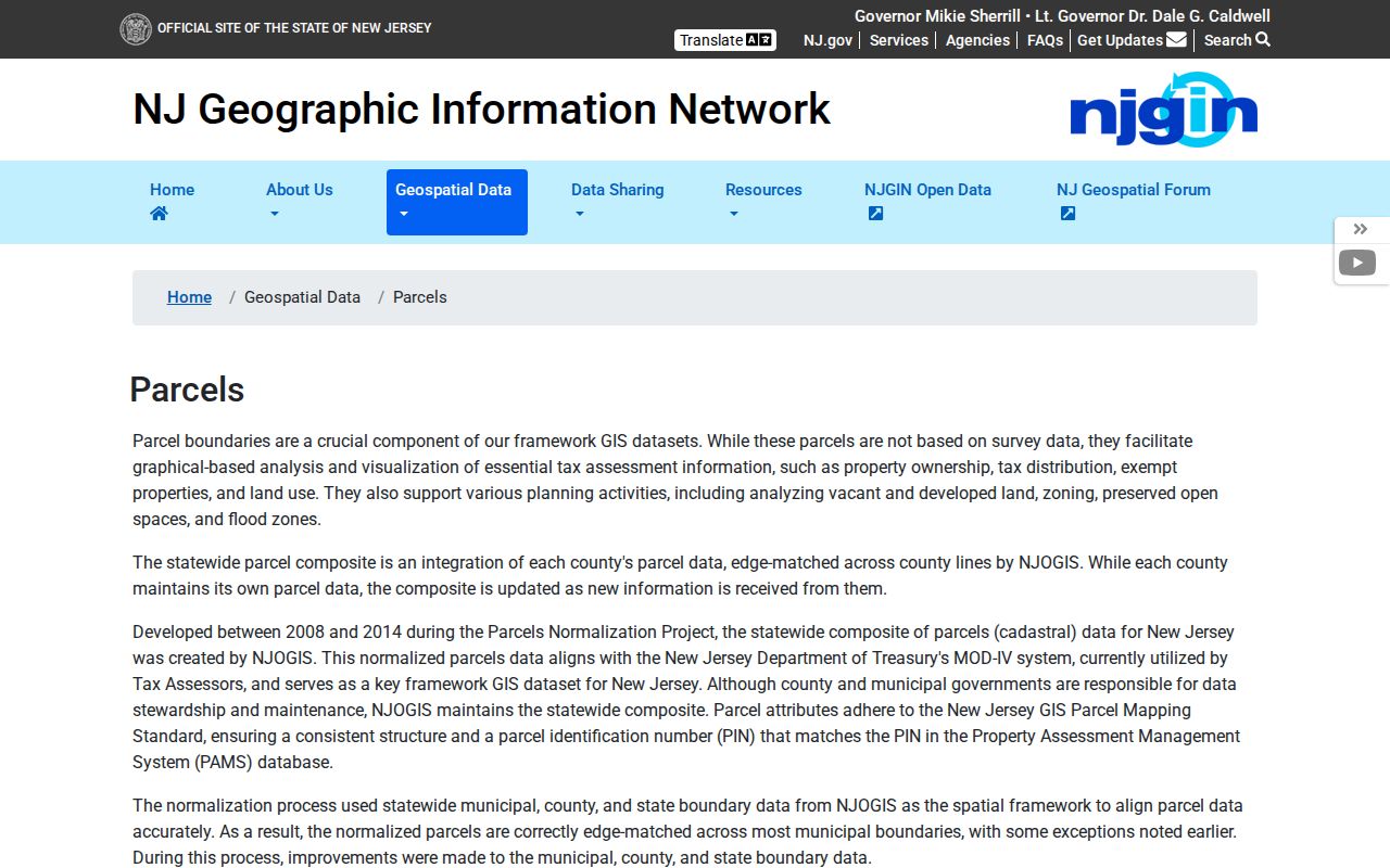
If a parcel name is masked, keep the parcel identifiers and ask the appropriate custodian about the official record. The state warns that a hosted parcel view is not a certified tax map, and county or municipal stewardship can produce update differences at the edge of a map. For a full named-street record trail, use the Hoboken street directory rather than turning a single block search into a citywide list.
Hoboken Neighbors and Sanborn Sheets
Hoboken Public Library has Sanborn map coverage for 1906–1938 on microfilm or online. These sheets can show a building footprint, use and neighboring numbers in a particular era. They are especially useful when a directory gives an old address or when redevelopment makes a modern map hard to compare. A Sanborn sheet describes the built block, not who occupies it now.
Pair the sheet with the current parcel and a directory page. That sequence can explain a building and its position without projecting a historical household into the present. The library’s Special Collections also hold maps, photographs, oral histories and local-history material that can supply a cited, period-specific context.
For the architectural layer, the 2019 Hoboken Historic District Architectural Survey organizes reports by street. Volume 3 covers 1st–11th, 13th, 14th, Adams and Bloomfield; Volume 4 covers Castle Point Terrace, Clinton and Garden. Volume 5 includes Grand, Hudson, Newark, River and Washington, while Volume 6 continues Washington and includes Willow Avenue and Court. Confirm the survey volume and property page for the target address, then compare it with the 1979 New Jersey Historic Sites Inventory material and the current parcel.
Hoboken Neighbors in Directory Pages
Read the full directory page, not only the first surname that appears. Hoboken DigiFind-It provides digitized directories, newspapers, maps and local documents, while HPL provides a historical research route when an image or OCR is incomplete. Capture the directory year, part or page, name, occupation, printed address, household notation and adjacent entries. Search the street as well as the surname because OCR can split names and numbers differently.
The 1861–62 directory uses entries such as a business address followed by “h” and another address. That is a useful clue to a work or home context, but the inspected pages did not supply a definitive abbreviation key. Preserve the printed form and use HPL staff or surrounding entries for interpretation. A directory neighbor is therefore a dated page relationship, not an automatic modern one.
HPL lists city directories on microfilm or online for 1902–1907 and 1909–1911. Its historical catalog also includes census microfilm, including federal years from 1850 through 1920 with the usual 1890 gap, and New Jersey state census years 1885, 1895 and 1905. Pairing a directory page with the nearest census is a way to test a historical household without claiming that the same address remains current.
Hoboken Neighbors and Civic Geography
Hoboken has six wards and multiple voting districts. Those labels are useful for election administration and for routing a defined voter-list question, but a ward is not a neighborhood association and does not prove residency. The state registration-check tool is intended for individual status. Public voter-file rules protect signatures, Social Security numbers and MVC identification numbers, and Daniel’s Law protects approved home addresses.
No official city page listing current neighborhood associations or homeowners’ associations was located. The documented civic alternatives are the City Clerk’s ward and municipal-record route, HPL’s organization holdings, and the Museum’s collections. They are valuable context for a block, but they are not an association roster or a current membership directory.
| Documented resource | Contact or access | Useful block context |
|---|---|---|
| Hoboken City Clerk | 94 Washington St.; (201) 420-2000 ext. 1030; cityclerk@hobokennj.gov | Ward information, municipal records and OPRA routing |
| HPL Special Collections | Appointment; (201) 420-2346 ext. 5101; reference@hoboken.bccls.org | Directories, census microfilm, maps, newspapers and organization material |
| Hoboken Historical Museum | 1301 Hudson St.; (201) 656-2240; collections@hobokenmuseum.org | People files, photographs, maps and contextual collections |
Hoboken Neighbors Building Records
Construction, zoning and SDL records can explain activity around a building. Construction Code handles plan review and permits, and the SDL portal states that property information and permit-status functions are available. The public search-field set was not captured, and some workflows require an account. Start with a date, address, permit number or defined project rather than a broad name search.
Permit files may name an owner, applicant, architect, contractor or responsible agent. Those are documented transaction roles, not a way to establish who lives nearby. When status alone is unclear, request the underlying application and final disposition through the relevant office or a specific OPRA request.
Hoboken Construction Code accepts its printable applications at 94 Washington Street, and the Zoning Office routes certificates, permits and verification requests. A narrow request to the right municipal office can be more useful than a broad person search. If a record is not in a portal, use the City Clerk’s written OPRA route and identify the address, time period, record type and preferred delivery format.
Hoboken Neighbors Official Sources
Official records and commercial neighbor tools answer different questions. A private result can be a lead, but it does not replace the issuing office’s record or explain the date, redaction or role behind the data. Use a primary parcel, instrument, directory image or municipal file to test any claimed connection to a Hoboken block.
| Source type | Best use | Limit to keep in view |
|---|---|---|
| Official parcel, tax or deed record | Test a mapped parcel, recorded party, block/lot and record date | Ownership and mailing evidence do not prove current occupancy |
| Official directory, archive or map | Test a dated household, building use or page-adjacent address | OCR, coverage gaps and historic numbering need page-level review |
| Commercial neighbor tool | Generate an unverified lead to test against a custodian record | Not the official source and not a substitute for date, role or redaction context |
Hoboken Neighbor Lookup Limits
OPRA, N.J.S.A. 47:1A-1 et seq., permits access to many records but requires custodians to protect exempt material. A home address or telephone number can be redacted where privacy outweighs the public interest. New Jersey’s Address Confidentiality Program provides a substitute address for eligible people, and Daniel’s Law can mask protected home-address information in local and state systems. Do not reverse-map a substitute or masked address.
Keep research minimal and source-specific. A public index does not justify publishing full birth dates, signatures, financial data, unredacted safety addresses or sensitive case details. A no-result may reflect a record boundary, redaction, different custodian or a historical gap. Verify the parcel, venue, date and source before relying on any block result.
Lawful use. Use block records for family history, property context, reconnecting and civic questions. Do not use them to watch, harass, threaten, intimidate or expose anyone.